Thursday, April 17, 2008

The Return of Captain Holly's Hiking Blog, 2008 Edition

After a long hiatus, the sleepy Warren is slowly stirring: Captain Holly's Hiking Blog is back for another summer of adventures in the Great Outdoors.


This year it starts at Arches National Park. That's me, standing under Delicate Arch, the unofficial symbol of the State of Utah.


I attended a conference in nearby Moab last week, and instead of paying about $75 a night for a hotel room, I opted to camp in Devil's Garden campground in the park for only $15 a night. Not bad, but you have to make reservations well in advance, as the campground fills up quickly during the spring season.


While the park is a desert area, it is a cold desert, meaning it gets snow. And it gets cold enough to freeze in April, as this picture clearly shows. The weather was cold and rainy during the first couple of days, but by the time the weekend came around it had cleared out and the temps were in the 70's.


There are several hiking trails in the park, none of which are very difficult other than some scrambling over slick sandstone. But usually as long as it's dry there isn't a problem. And the red Entrada sandstone formations are spectacular.


This is Landscape Arch on the Devil's Garden trail. It's in the terminal stages of arch-hood, as in 1991 a huge chunk fell from it and as you can tell, it's getting quite thin on one end. Another such loss and it might be gone for good.


The area has long been inhabited by humans; some Utes left these pictographs a couple of hundred years ago.
Overall, it was a great trip. I was able to hike almost all the trails. I hadn't done much hiking in red rock country before this, but I think I'll spend more time here.
If you go, the best times are in the spring and the fall before Memorial Day and after Labor Day. Winters are very cold -- trust me on this -- and summers are just too hot to enjoy. But there will be much smaller crowds.

Labels:

Monday, August 27, 2007

Hikeblogging: Santaquin Peak, Uinta National Forest, August 25, 2007.

After my unexpected adventures in mountaineering on Twin Peaks last month, I was looking for a hike this month that would be more pleasant and less taxing. Specifically, I wanted a hike that would give me a good workout (~10 miles round trip) and allow me to bag a decent peak (>10,000 feet elevation) but that wasn't too steep (less than 1,000 feet elevation gain per mile distance) or too far away (<60 miles) and had a decent trail going all the way to the top.

After consulting my hiking guides, I found that Santaquin Peak filled the bill perfectly.


The trail begins up Payson Canyon at the Loafer Mountain trailhead. The trail itself is quite well-maintained and easy to follow, but there are a couple of intersections and if you take the wrong turn you'll end up somewhere else. Follow Forest Service trail 098 all the way up.


As you go up the long ridge of Loafer Mountain you can see the Payson Lakes in the basin below. David Day of Utah Trails recommends doing this hike in the fall, and I can see why: There's alot of aspen and maple trees in the forest here.


Off in the distance is the imposing Mount Nebo, the highest point in the Wasatch Mountains, and a peak that is on my list for next year. I would have climbed it this year, but I didn't have the time to the recommended two-day backpacking trip.

Up on top there's a mailbox containing a notebook for peakbaggers to sign, along with some emergency supplies. Thanks to anyone who came here after reading my entry.


You have a great view of Utah Valley from on top, almost as good as the one on Timpanogos with only a fraction of the crowds. I only ran into about 20 hikers all day, and half of those were from a single ambitious Boy Scout troop from the town of Woodland who were going to descend the front face of the mountain to get home. I wonder if they made it.


The top is covered with interesting rocks made of sandstone or mudstone with layers of halite (mineralized salt) sandwiched in between. Apparently this mountaintop was a flat shallow sea basin during the Paleozoic Era that repeatedly dried out and then flooded, leaving the salt from the previous evaporations.

Overall, this hike was everything I hoped it would be. It was steep coming down in some spots, and I got a couple of small blisters and a mild sunburn, but I wouldn't mind hiking this mountain again some future autumn.

Labels:

Sunday, July 29, 2007

Hikeblogging: Twin Peaks, Wasatch-Cache National Forest

Yesterday I did what turned out to be the most difficult hike I've ever tried (outside of the Marines): Twin Peaks in the Wasatch Mountains east of Salt Lake City.


The lower portion of the trail is relatively easy and winds through the forest until you reach the main basin. From here you can see your goal. I originally wanted to climb Dromedary Peak (far left) but after seeing how steep it was on the sides I decided to try Twin Peaks (second from right).

The trail soon disappears and you hike through meadows and open spaces of loose rocks. From this picture it looks as if Twin Peaks is not that far away, but even though it's only about another 3/4 miles you still have about 1,500 feet of elevation to climb, as I would soon find out.


I finally made it to the top after slowly climbing up the steep rock face. In the distance to the south you can see Mount Timpanogos. This view is from East Twin, at 11,330 feet. West Twin, just another quarter mile to the west of this point is 11,328 feet. I was too tired to try and bag both in one day.


After consulting my topo map, I determined that descending the north face of the mountain would be just as difficult as going back down the way I came up on the south face. Besides, there appeared to be a decent trail leading down from the top. I followed it, and found out it wasn't a human trail, it was a game trail. One used by mountain goats, like the two in the center of this picture.


I began to realize that mountain goats tend to live in places that humans can't easily get to. Sure enough, as I continued my descent I noticed that the ridgeline down into the canyon was made up of bare, potentially slick outcrops of shale, with stair-like miniature cliffs about 10-20 high. In other words, I was trapped unless I found a route down. I eventually found a very steep couloir and I carefully picked my way down, almost causing a rockslide once or twice and losing my jacket in the process. But I finally made it down and lived to blog about it.

In consulting my copy of Veranth's Hiking the Wasatch I found out later that I had descended by a route known as the Robinson Variation, meaning that some guy named Robinson was crazy enough to go up that way. As for me, I'm proud I made it to the top, but I'm not going to try that hike again for a while.

Labels:

Monday, July 02, 2007

The Return of Captain Holly and his Hiking Blog: Bull Mountain, Sawtooth National Forest

I've been terribly busy these past few months, and it's been difficult for me to indulge in my one of my favorite pastimes: Hiking. I finally was able to stop by a secret corner of Utah on my way back from family business in Idaho, the Raft River mountains just south of the Idaho border in the Sawtooth National Forest.


Bull Mountain is on the list of many local peakbaggers because it is the highest point in Box Elder county and many hikers make it their goal to "bag" to the highest peak in each county in Utah. The place has everything Captain Holly loves: a nice fishing stream, good campsites, beautiful topography, and very few people. The area is quite isolated and so far not many people care to go there. I was able to camp in a Forest Service campsite that was not even full on a Friday night in late June.

The stream is full of catchable rainbow, brown and brook trout, with some even getting to be about 10-12 inches long. I ended up keeping a nice brown trout for dinner.


Up on top you can see the canyon with its heavy timber. I actually hiked to the top while hunting here back in the 1980's, but as I was looking for deer and not the summit I didn't actually "bag" the peak.

In fact, it's not much like a mountain up on top. It's just flat meadows, full of wildflowers. Quite beautiful if you get there in the right season.


The actual "summit" is little more than a high spot in the meadow. Under this pile of rocks was a jar with a notebook in it for peakbaggers to sign, but since it was covered with bird crap (I guess eagles or hawks like sitting on it) I wasn't going to dig it out and sign it.

Overall, not a bad hike. It's only about 9 miles round trip, and the solitude and camping are worth it. It would have been even better if I had known there was an ATV trail that actually went up to nearly the top, as I ended up brush-busting for the first mile or so. Plus, I'm out of shape and I forgot to take my heart meds and was really having a hard time for the last half-mile. But I made it, and so I can mark this one off my list.

Labels: ,

Saturday, August 26, 2006

Hike Blogging: Mount Timpanogos, Uinta National Forest

Today I climbed one of Utah's most popular and recognizable peaks, Mount Timpanogos.


There are two well-maintained trails that get to the top, one at Aspen Grove and the other at Timpooneke. Aspen Grove is shorter (6.7 miles) but it is also slightly steeper; Timpooneke rises from 7,340 feet to 11,749 feet in about 7.1 miles. Since after my recent Mount Olympus hike I was tired of really steep trails, I decided to take Timpooneke instead.

The trail rises through a series of forested glacial basins for about four miles. It was nice and cool due to recent rain and I was able to do a pretty good pace.


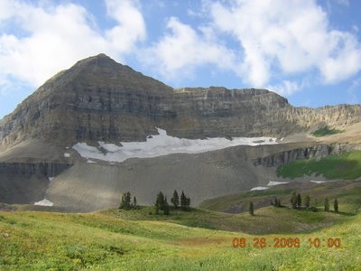
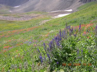
After about 4.5 miles, you get to Timpanogos Basin, a large glacial cirque carpeted in wildflowers. As you can tell, Mount Timpanogos is made up of sedimentary rocks that have been pushed upwards but still are horizontal. There are several such cirques all around the mountain; the next one to the south contains the Timpanogos "glacier", in reality a large permanent snowfield.

Another view of the wildflowers.

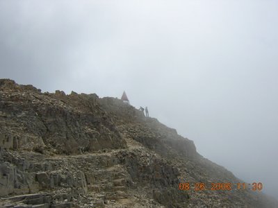
On the top there is a simple shelter used for surveying purposes. As you can tell, it was very cloudy and cold when I got there, but the sun came out a few minutes later. I ate my lunch there while some 40-50 people came and went.


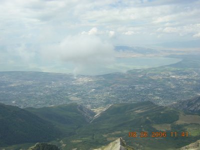
The peak overlooks Utah Valley. These are the towns of Pleasant Grove and American Fork, with Utah Lake in the background. Just to the south is Provo and Brigham Young University, which explains in part why it seemed ever other person on the trail was between 18-24 years old and was wearing some type of BYU attire.

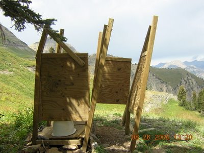
As Timpanogos is contained in a designated wilderness area, the Forest Service tries hard to keep things as pristine as possible. This "toilet" is set up along the trail; one look at it explains why most people just go in the trees instead.

Overall, it was a pretty good hike. I can see why some Utah hiking guides call it the "best hike in Utah". The trail is in good shape, it's well-graded, and the scenery is beautiful. I was impressed at how quickly I was able to do the hike; it took me 4 hours exactly to get to the top, and I did the whole 14.2 miles in just over 7 hours. The only drawback was the crowd of people. It would have been much nicer had I gone during the middle of the week.

Labels:

Sunday, August 20, 2006

Hike Blogging, Mount Olympus, Wasatch-Cache National Forest

Although I lost all the pictures of my last hike in the Great Hard Drive Meltdown of '06, I'm still going to post this report for those unsuspecting souls who might try this hike.

Mount Olympus is a large block of Paleozoic sedimentary rock that has been thrust upwards onto its side. As a result, it's very steep with the north face being almost vertical. The peak is 9,026 feet above sea level and is quite prominent on the skyline. Like Grandeur Peak, the easy accessibility and views it provides make this a popular hike.

But certainly not an easy one. I knew it would be steep -- the trail goes from 5,100 feet elevation at the trail head to over 9,000 in just 3.5 miles. But I didn't know it would be so rugged; the last half of the trail is steeper and rockier than the first half, and the last few hundred yards require some low-intensity rock-climbing.

Also, there are rattlesnakes in the brush near the trail. We know this because one of the leashless dogs belonging to a stupid Russian lady and her daughter who were hiking just in front of us found a rattlesnake and naturally got bit on the nose. Whether or not they made it down in time to save him I do not know.

Not a bad hike, but not my favorite one, either. Even though I don't have pictures of it, I don't think I'll do it again anytime soon. Instead, I'll save my energies for the most popular hike in Utah: Mount Timpanogos. I'll be doing it this weekend.

Labels:

Thursday, July 27, 2006

Hike Blogging: Mt. Etna, Sicily

Editor's Note: Mount Etna is an ACTIVE volcano, so always be careful when attempting anything it's slopes.

Spurred by the Cap’n’s descriptions of his hikes to the tops of local mountains, the Great El-ahrairah has decided to take up the challenge. What follows is a report of my hike up, not some wimpy mountain but to the top (well not quite but close) of an active volcano, Mount Etna on the island of Sicily.

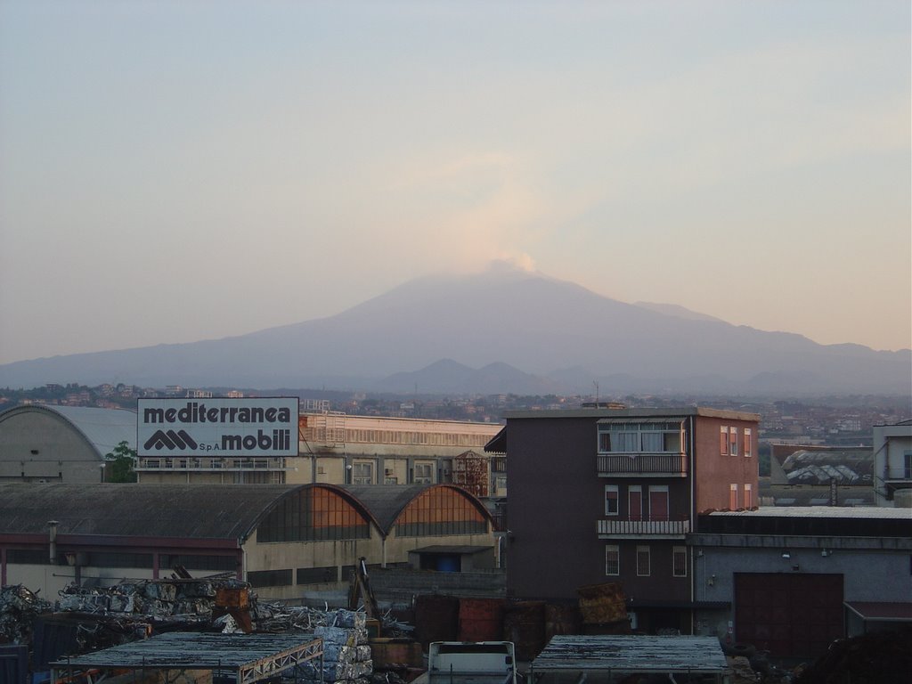
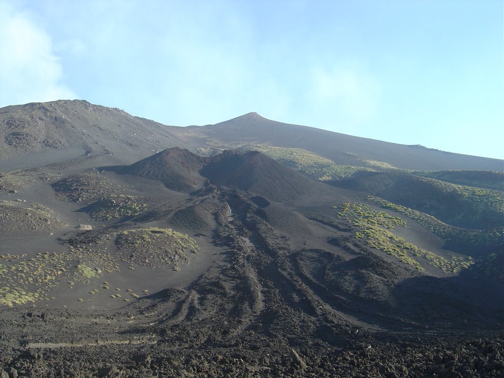
Mount Etna is Europe’s tallest active volcano. It erupts about every two to three years and depending on the eruption, it could be something rather destructive (like in 2001) or just a few volcanic belches (like today). It dominates the skyline of Catania and eastern Sicily at it highest point of 3,350 meters (10,990 feet). It is currently belching lava, but there is no danger to the surrounding communities since it’s all flowing down into a natural catch basin called Vale del Bove.


There are two ways to get to Etna, from the south thru the town of Nicolosi or from the north thru Linguaglossa. Since Nicolosi is just above Catania, I decided to go this way. The road winds up the side of the mountain thru old lava flows until to you arrive at Rifugio Sapienza at 1,892 meters (6207 ft) in altitude. Rifugio Sapienza was somewhat destroyed during the 2001 eruption, but this is the quickest way up the mountain to see the lava. There is a gondola ride that will take you up the mountain to 2500 Meters (8202 ft) at the foot of the Montagnola crater from the 1763 eruption. There you can take a special bus which will drive you father up the mountain to see the Torre del Filosofo crater at 2900 Meters (9514 ft) which will also get you much closer to the site of the current eruption. The whole round trip (up and down the mountain to see the whole shebang) costs 45 Euro. When I first came to Sicily in 1999, I went up to the top of Etna on one of these tours, but I don’t remember much about it other than it was windy and cold (for June) and I got to see actual, hot, flowing lava.

I poked around on the Internet and found a hike up the mountain to the site of the Montagnola crater and then back down. From there I thought that I would be able to see the lava in the Vale del Bove. The hike would take about four hours and would rise about 750 Meters (2469 feet). Before I started the hike, I wandered over to look at the twin craters of M. Silvertri Superiore and Inferiore. The road to Zafrerana Etnea runs between the two and back in 2001, they were still smoking. The end of my hike would have ended here, so instead of trying to find the trailhead to start my hike, I decided to go backwards and start at the end of the hike.


The first part of the trail passed thru lava fields and I was able to see the vent where the lava came pouring out in 2001 and destroyed some of Rifugio Sapienza. After that, I kind of lost track of the trail (it happens) and strayed off a bit, but since there is basically no vegetation on the side of the volcano, it wasn’t all the hard to see where I was going.


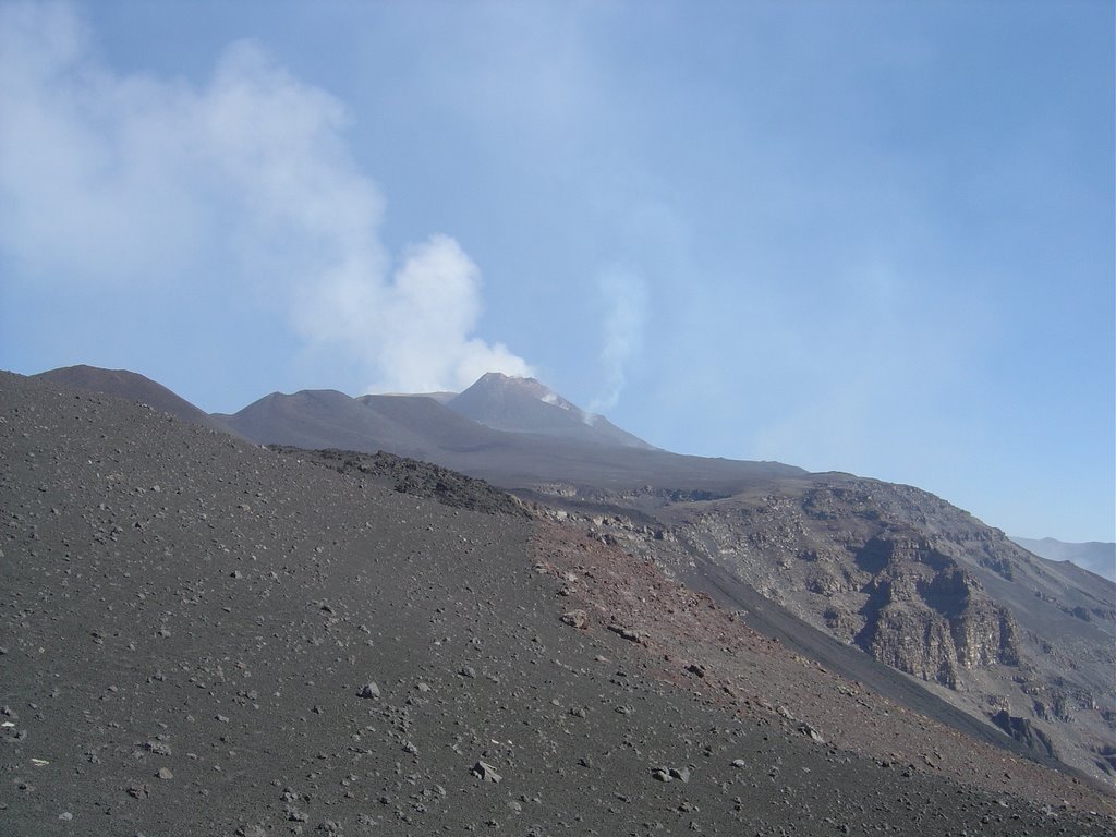
After about two hours of doing switchbacks up the side of the mountain thru volcanic sand and rock, I arrived at the top where the trail was. From there I could see the lava in the Vale del Bove


and also the summit where the lava was belching out.


From the parking lot down below, you could hear the lava exploding out of the crater and I expected to see a Hawaii witch doctor running around warning everyone that the "gods where unhappy today".

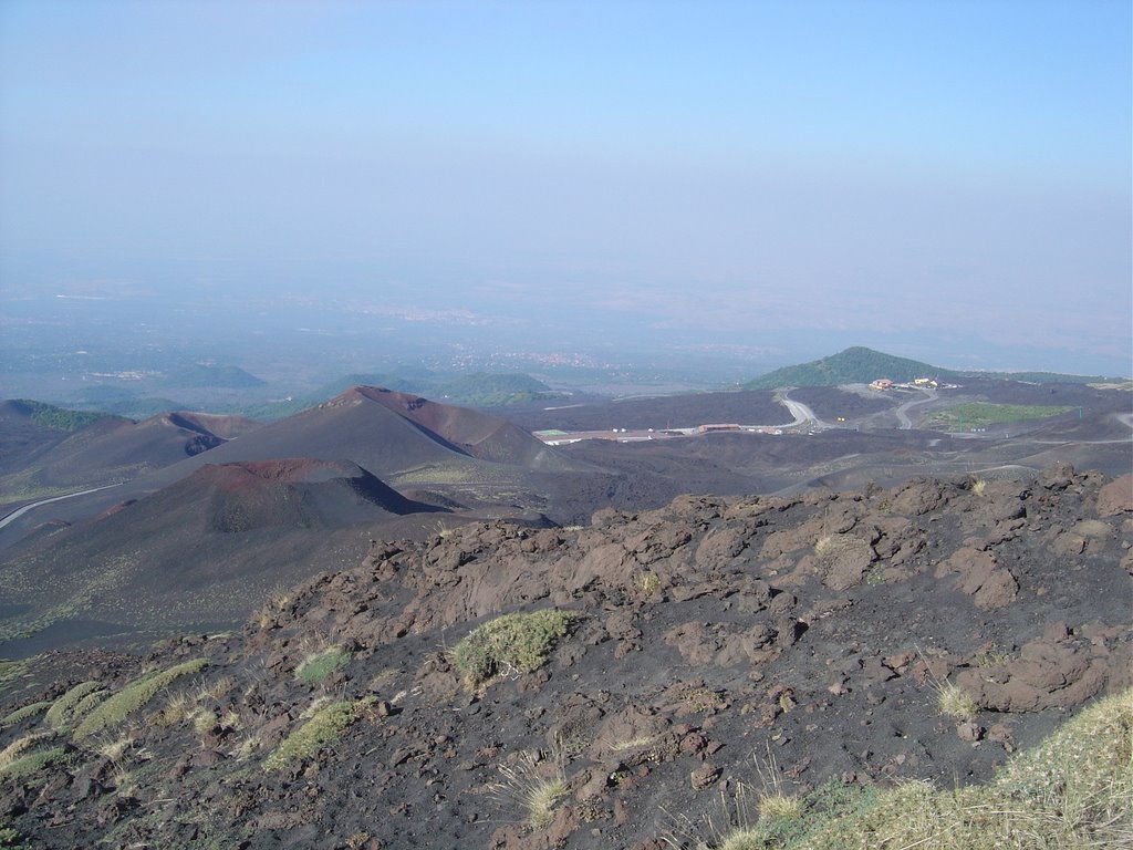
Here's a shot from the trail at the top showing three craters (M. Silvestri Superiore and Inferiore, another crater and Rifugio Sapienza in the distance and beyond that is the cities of Nicolosi and Catania.

My trip down the mountain was much less taxing because I basically pussed out and paid 12 Euro (Ladri!!!) and ride the gondola back down the mountain to Rifugio Sapienza. Lest the Cap’n think that I’m not the rabbit that I used to be when I dragged his furry rear-end up Timpanogos, my boots where starting to make hamburger out of my feet, so I decided to pay the 12 Euros and save my feet for another day. At the bottom, I kind of wandered around looking at the tourist trap shops that are located at the parking lot and then called it a day.

Labels: ,

Monday, July 17, 2006

Hike Blogging: Ibapah Peak, Deep Creek Mountains

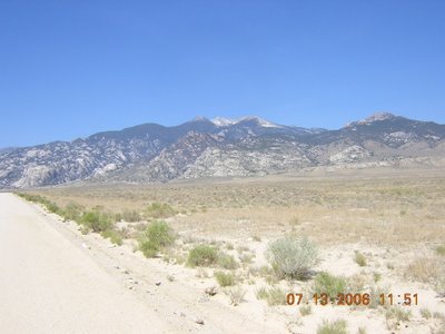
I spent a couple of days last week climbing Ibapah Peak, the highest point in the Deep Creek Mountains in extreme western Utah, about 60 miles south of the gambling oasis of Wendover, Nevada. It's quite a remote area and isn't that well-known (yet).


At 12,087 feet tall, Ibapah towers almost 7,500 feet above the valley floor. The Deep Creek Range can be accessed from Wendover or if you're looking for adventure, by way of the old Pony Express Route. But if you go that way, be aware that you need to take extra supplies. You're about 100 miles from the closest civilization.


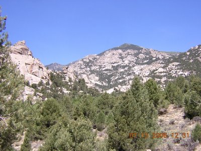
The trailhead to the top of Ibapah is located in Granite Canyon. And there is plenty of granite in the canyon, as this picture shows. It looks very much like the City of Rocks in Idaho. In fact, I predict if the area is ever designated as wilderness it will soon be overrun with climbers wanting to try new routes, just like at City of Rocks.


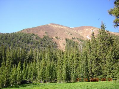
Up near the top, the vegetation changes from pinon-juniper woodlands to lush spruce-fir forests and meadows. This is a picture of Red Mountain, the peak south of Ibapah. It looks strikingly like a mountain in the High Uintas Wilderness Area.

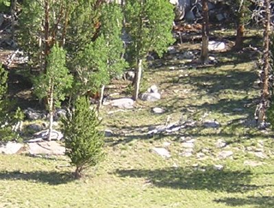
If you look closely just to the left of center in this picture, you'll see a mountain lion (Felis concolor) running up the hill. We surprised him while walking through a meadow. The wind was in our faces and he had no idea we were there until I made a noise. Then he was off like a shot and over the rocks and ridgeline -- about 200 yards -- within 10 seconds. The fact that he was out sauntering around in broad daylight demonstrates that this area doesn't get many visitors.


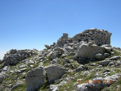
Ibapah peak is just a giant block of Tertiary granite. Up on top, there's the remains of an old heliograph station, which is a very nice place to have lunch. The trail going to the top was in pretty good shape and is marked by several rock cairns. The altitude didn't bother me as much as I thought it would, although the hike was pretty strenuous.

From the top, you can see almost 100 miles. This is Haystack Peak, which is located only a couple of miles to the north of Ibapah and is almost as high.

Overall, it was a great hike but one of the hardest I have ever done. We backpacked in the night before, and that part was very taxing due to the heat and the steepness of the trail. One could camp down by the trailhead -- there are several nice campsites and a creek with small trout in it -- but it's about 13.5 miles round trip from there to the top. Quite a hike for one day, especially since you're going from 6,800 feet to over 12,000. It's better to split it in half, or even thirds.

Labels:

Sunday, June 25, 2006

Hike Blogging: Gobbler's Knob/Mount Raymond, Wasatch-Cache National Forest

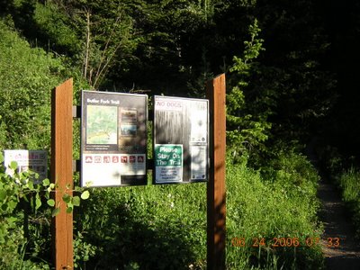
Yesterday's hike took me to the top of not one but two peaks, Gobbler's Knob at 10,246 feet and Mount Raymond at 10,241 feet. The trail begins at the Butler Creek trailhead, about 10 miles up Big Cottonwood Canyon in Salt Lake County.


I got to the trailhead early and avoided any problems with parking. Most of the trail passes through the Mount Olympus Wilderness Area and is not too difficult, but the first part is quite steep. Elevation at the trailhead is 7,120 feet, for an overall elevation gain of over 3,100 feet.


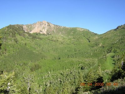
This is Mount Raymond seen across from Mill A Basin. As the name implies, it was heavily logged in the 1800's. The trail goes through aspen groves to Baker Pass there on the right of the picture. From there, you follow it up the ridgeline to either Mount Raymond on the left or Gobbler's Knob on the right.


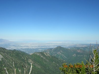
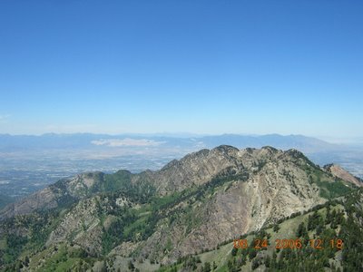
A view of downtown SLC as seen from the summit of Gobbler's Knob. The trail going to the top is fairly steep but much easier than the one going to the top of Mount Raymond, as I would soon find out. There also were several snow fields that covered the trail. The mountain partially blocking the view of Salt Lake City is Grandeur Peak.


Looking out towards Mount Olympus from the summit of Mount Raymond. The tan patch on the far mountains is Kennecott Copper's Bingham Canyon mine. The trail to the top of Mount Raymond is even steeper than Gobbler's Knob and the last quarter mile or so you're scrambling over rocks on a knife-edge ridge. If you're afraid of heights or don't have good balance, don't try it. Trust me on this one.


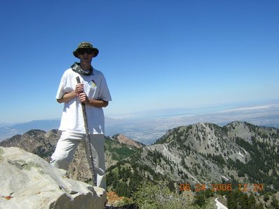
Captain Holly on top of Mount Raymond, with the Salt Lake Valley in the background. There was a plastic canister on top that had a notebook for people to sign. I left The Warren's address in it, so if you're here because you climbed Mount Raymond, congratulations.

My cheap $2.00 Wal-Mart pedometer was right on again, showing that I hiked just slightly under 10 miles. Overall, it was good training for the next hike on my schedule -- the dreaded Ibapah Peak.

Labels:

Thursday, June 22, 2006

Hike Blogging: Ben Lomond, Wasatch-Cache National Forest

I did this hike on September 6, 2004.

Ben Lomond is a 9,712-foot high peak on the north end of Weber County. It is a popular but difficult hike, approximately 12 miles round-trip from the North Fork Park trailhead and 14 miles from North Ogden Pass (one could be lazy and drive up to Willard Peak and then just hike about 3 miles along the Skyline Trail, but Captain Holly loves a challenge).


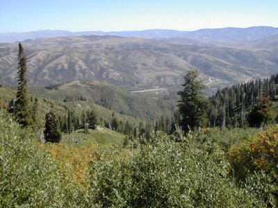
A view of Ogden Valley from the Skyline Trail.

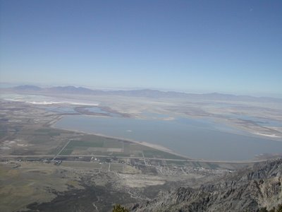
Not surprisingly, you can see alot when you get up on top. This is a view of Willard Bay State Park, looking to the northwest.

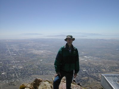
Captain Holly on top, looking south towards Ogden. Despite it being sunny day in early September, the temperature on top was in the 50's -- hence the jacket.

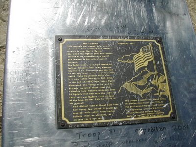
The local Boy Scout troops have installed a metal box that contains a notebook for those who reach the summit to write their impressions. Most agree this is a great hike.

Labels: