Hike Blogging: Ibapah Peak, Deep Creek Mountains
I spent a couple of days last week climbing Ibapah Peak, the highest point in the Deep Creek Mountains in extreme western Utah, about 60 miles south of the gambling oasis of Wendover, Nevada. It's quite a remote area and isn't that well-known (yet).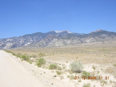
At 12,087 feet tall, Ibapah towers almost 7,500 feet above the valley floor. The Deep Creek Range can be accessed from Wendover or if you're looking for adventure, by way of the old Pony Express Route. But if you go that way, be aware that you need to take extra supplies. You're about 100 miles from the closest civilization.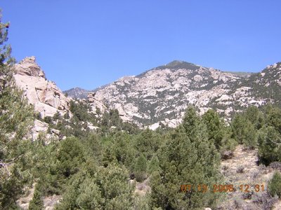
The trailhead to the top of Ibapah is located in Granite Canyon. And there is plenty of granite in the canyon, as this picture shows. It looks very much like the City of Rocks in Idaho. In fact, I predict if the area is ever designated as wilderness it will soon be overrun with climbers wanting to try new routes, just like at City of Rocks.
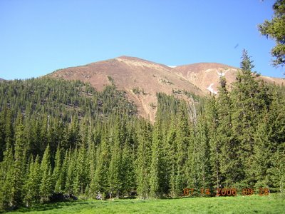
Up near the top, the vegetation changes from pinon-juniper woodlands to lush spruce-fir forests and meadows. This is a picture of Red Mountain, the peak south of Ibapah. It looks strikingly like a mountain in the High Uintas Wilderness Area.
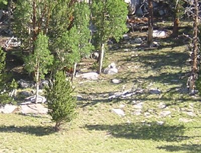
If you look closely just to the left of center in this picture, you'll see a mountain lion (Felis concolor) running up the hill. We surprised him while walking through a meadow. The wind was in our faces and he had no idea we were there until I made a noise. Then he was off like a shot and over the rocks and ridgeline -- about 200 yards -- within 10 seconds. The fact that he was out sauntering around in broad daylight demonstrates that this area doesn't get many visitors.
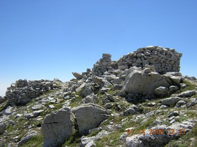
Ibapah peak is just a giant block of Tertiary granite. Up on top, there's the remains of an old heliograph station, which is a very nice place to have lunch. The trail going to the top was in pretty good shape and is marked by several rock cairns. The altitude didn't bother me as much as I thought it would, although the hike was pretty strenuous.
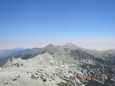
From the top, you can see almost 100 miles. This is Haystack Peak, which is located only a couple of miles to the north of Ibapah and is almost as high.
Overall, it was a great hike but one of the hardest I have ever done. We backpacked in the night before, and that part was very taxing due to the heat and the steepness of the trail. One could camp down by the trailhead -- there are several nice campsites and a creek with small trout in it -- but it's about 13.5 miles round trip from there to the top. Quite a hike for one day, especially since you're going from 6,800 feet to over 12,000. It's better to split it in half, or even thirds.
Labels: Hiking
posted by Captain Holly @ 00:00
3 comments
![]()
![]()

3 Comments:
You are absolutely right! I hiked Ibapah yesterday and it is one of the best hikes I have ever done. Yet, it was one of the most difficult due to the length and incline. You can read my post and see photos at http://ogdeninsights.blogspot.com/2009/07/utah-adventure-ibapah-peak.html
Amazing natural beauty!
Love the Deep Creeks. Am hoping to get back there once my daughter is old enough. Did that hike way back in 2001. It is strenuous, but worth it.
Hi there - I am heading out to Ibahpah this weekend. Do you think a dog could do this hike? My pup and I hike frequently and have done other hikes together, so he is in good shape. Just wondering if this trail has sharp rocks?
Alicia www.girlonatrail.com
Post a Comment
<< Home